

If you are thinking about moving to the Charleston area, figuring out how you’ll get from Point A to Point B is probably high on your checklist. Mount Pleasant is beautiful, but it is also spread out. It sits on a peninsula wedged between the Wando River, the Cooper River, and the Atlantic Ocean, which means geography dictates a lot of your movement.
For the most part, life here is car-dependent. While we are seeing more bike paths and bus routes pop up, the reality is that most residents rely on their vehicles for daily errands. However, if you are working downtown or just want to enjoy a weekend without parking headaches, there are some clever workarounds involving water taxis and bikes.
Here is the lowdown on getting around Mount Pleasant SC, from the major traffic arteries to the best ways to skip the gridlock.
Driving & Major Roadways
Because of the town’s shape—long and somewhat narrow—traffic tends to funnel onto a few key arteries. Understanding how these roads interact is key to living in Mount Pleasant without losing your mind in traffic.
US Highway 17 (North/South) This is the spine of the town. Whether locals call it “17,” “Highway 17,” or “Johnnie Dodds” (the southern section), it’s the same road. Almost all major commercial hubs, grocery stores, and neighborhood entrances feed off this highway. Expect heavy volume here, especially during school drop-off and rush hour.
Interstate 526 (Mark Clark Expressway) Think of I-526 as the perimeter loop. It cuts across the southern part of Mount Pleasant and serves as the main connector to North Charleston (where the airport is) and West Ashley. It’s vital for getting out of town quickly, but the interchange where it meets Highway 17 is a known bottleneck.
Coleman Boulevard Coleman is the heart of the “old” Mount Pleasant commercial district. It runs parallel to the harbor and is lined with restaurants, shops, and apartments. The speed limits are lower here, and it’s much more pedestrian-friendly than the highway. It’s the scenic route, but it can get clogged with beach traffic in the summer.
Rifle Range Road This is a key secondary route running parallel to Highway 17. Locals often use Rifle Range to bypass highway congestion, though it has become a busy corridor in its own right as more residential developments have sprung up along it.
There is a local saying you will hear often: “Mount Pleasant is 30 minutes from Mount Pleasant.” Because the town stretches so far north toward Awendaw, driving from the Dunes West area down to the Ravenel Bridge can easily take half an hour during peak times.
Commuting to Downtown Charleston
For many, the biggest question is about the commute into the city. Mount Pleasant is separated from downtown Charleston by the Cooper River, and there is exactly one way across for cars: the Arthur Ravenel Jr. Bridge.
The bridge is an engineering marvel and a stunning view, but it is also a funnel. The morning rush usually kicks in around 6:30 AM and stays heavy until 9:00 AM as traffic flows outbound toward the peninsula. If you are looking for jobs in Charleston SC, you need to factor this bridge time into your daily schedule.
The evening rush reverses the flow, with heavy traffic inbound returning to Mount Pleasant between 4:00 PM and 6:30 PM. While traffic moves steadily most days, accidents on the bridge can cause significant delays since there are no alternate bridges nearby. On a clear day, you can get from the base of the bridge to downtown in about 10 minutes, but if you are coming from North Mount Pleasant during rush hour, plan for a 35 to 45-minute trek.
Public Transit Options: CARTA Buses
While most people drive, the Charleston Area Regional Transportation Authority (CARTA) does provide bus service throughout the town. It isn’t as robust as what you might find in a major metro like D.C. or Boston, but it is a viable option for specific routes.
- Route 40 (Mt. Pleasant): This is the main line connecting major shopping centers and hubs along the Highway 17 corridor.
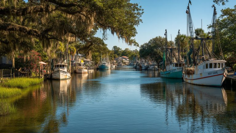
- Route 41 (Coleman Blvd): This route serves the Coleman Boulevard corridor, making it useful for getting to the Patriots Point area or the restaurants in Shem Creek.
- Route 42 (Wando Circulator): A local loop that serves the Wando Crossing shopping area and nearby medical facilities.
For those commuting further, there are express options that connect Mount Pleasant to other parts of the Lowcountry. CARTA has modernized in recent years, so you can use mobile ticketing apps and SmartCards rather than fumbling for exact change.
Charleston Water Taxi & Ferries
One of the best perks of living in a coastal town is that “public transit” can sometimes mean a boat ride. The Charleston Water Taxi is a fantastic alternative for reaching downtown, especially if you want to avoid expensive city parking.
The taxi operates a continuous loop connecting Patriots Point and the Charleston Harbor Resort in Mount Pleasant to downtown stops like Waterfront Park and the Aquarium. It generally runs on an hourly schedule from morning through early evening.
The cost is roughly $17 for an all-day pass, which allows you to hop on and off. While it might not be the fastest way to get to a 9:00 AM meeting, it is a popular choice for residents heading downtown for dinner, festivals, or just a day out. It turns a commute into a scenic tour of the harbor.
Walkability & Biking: The Mount Pleasant Way
If you prefer two wheels to four, you’ll want to know about the “Mount Pleasant Way.” This is an ongoing town project designed to create a connected network of multi-use paths that allow you to bike or walk safely across town without hugging the shoulder of a busy highway.
Wonders Way (Ravenel Bridge Path) This is the crown jewel of local walkability. The bridge features a protected lane specifically for walkers and cyclists. It’s a steep climb, but it connects Mount Pleasant directly to downtown Charleston. You will see hundreds of people here daily getting their exercise or commuting to work.
Old Village If you are looking at Old Village Mount Pleasant real estate, you are looking at the most naturally walkable part of town. This historic neighborhood was built before cars dominated, so the streets are narrower, tree-lined, and perfect for walking to local parks or the Pitt Street Bridge.
Suburban Trails Newer master-planned communities further north, such as Carolina Park or Park West, were built with internal trail systems. While you might still need a car to leave the neighborhood, you can easily bike to the neighborhood pool, schools, or internal commercial centers.
Accessing the Beaches
Living here means you are just minutes from the ocean, but getting there requires knowing your routes. Mount Pleasant sits right between two major beaches: Isle of Palms and Sullivan’s Island.
To get to Isle of Palms, most drivers use the Isle of Palms Connector, a long causeway that shoots straight off Highway 17/Johnnie Dodds Blvd. It’s a direct shot, but it backs up quickly on sunny Saturdays.
To reach Sullivan’s Island, you will take Ben Sawyer Boulevard at the end of Coleman. This takes you over a historic swing bridge.
A word of warning for new residents: Summer beach traffic is intense. If you plan to head to the beach on a weekend between Memorial Day and Labor Day, try to get there before 10:00 AM. Otherwise, you might spend more time sitting on the Connector than sitting on the sand.
Frequently Asked Questions
Is Mount Pleasant SC walkable?
Overall, Mount Pleasant is suburban and car-centric, so you cannot walk to everything. However, specific pockets like the Old Village, Coleman Boulevard, and I’on are very walkable, and the town is actively expanding its network of bike and pedestrian paths.
Does the Charleston Water Taxi run year-round?
Yes, the water taxi runs most of the year, though the schedule can vary based on the season or weather conditions. It is a reliable way to cross the harbor, but it’s always smart to check the current schedule before heading to the dock in the winter months.
Is there a train station in Mount Pleasant?
No, there is no Amtrak or commuter train station within Mount Pleasant. The nearest Amtrak station is located in North Charleston, near the Tanger Outlets and the airport, which is about a 20 to 25-minute drive via I-526.
How long is the drive from Mount Pleasant to downtown Charleston?
It depends heavily on where you start and the time of day. If you are near the bridge, it can take as little as 10 to 15 minutes. From the northern end of Mount Pleasant during rush hour, the drive can take 30 to 45 minutes due to traffic volume on Highway 17.